| Name
|
Size
|
Creator |
Creation Date
|
Last Modification Date
|
Labels |
Attached To |
|
ZIP Archive greon_3_5_181022.zip |
60.79 MB |
Marcus Slavenas |
Oct 22, 2018 13:03 |
Oct 22, 2018 13:03 |
|
Page: GREON Data
|
|
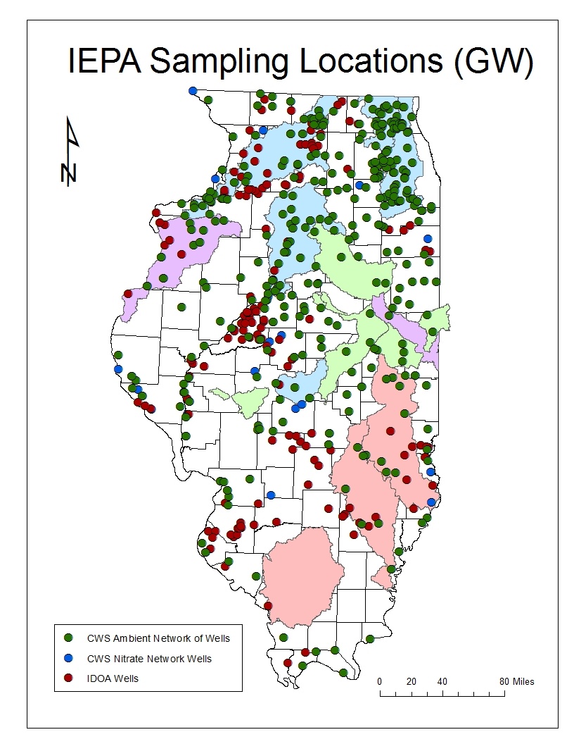
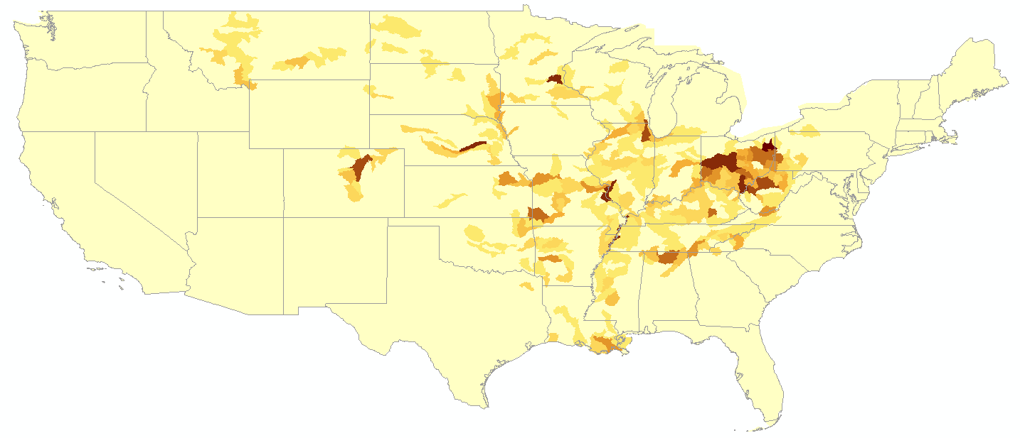
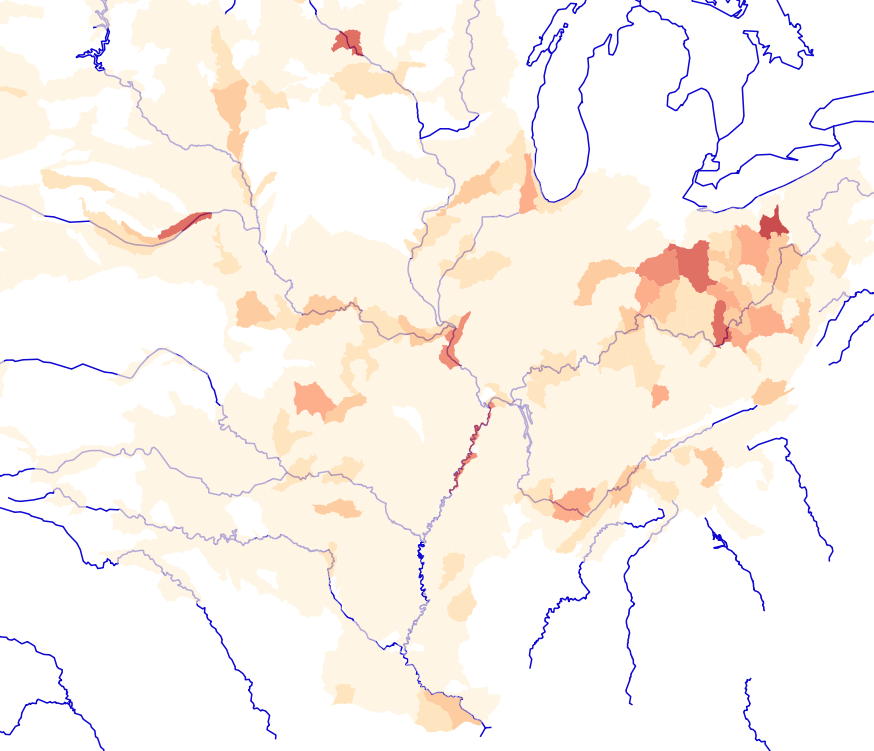
JPEG File IEPA GW.jpg |
399 kB |
Crystal Bartanen |
Dec 05, 2016 10:21 |
Dec 05, 2016 10:21 |
|
Page: IWRC Maps
|
|
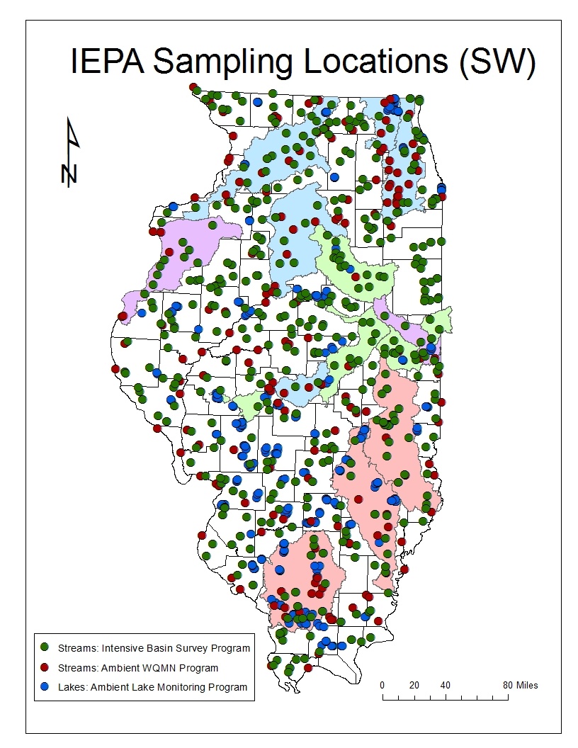
JPEG File IEPA SW.jpg |
493 kB |
Crystal Bartanen |
Dec 05, 2016 10:21 |
Dec 05, 2016 10:21 |
|
Page: IWRC Maps
|
|
ZIP Archive ile_20161028_163419.zip |
124 kB |
Jong Lee |
Oct 28, 2016 15:36 |
Oct 28, 2016 15:36 |
|
Page: IL EPA Ambient Water Quality Monitoring Network (AWQMN) data
|
|
Microsoft Excel Spreadsheet illinois Major rivers annual loads mcissac 2017.xl… |
39 kB |
Ted Kratschmer |
May 28, 2020 13:47 |
May 28, 2020 13:47 |
|
Page: Phase V - Interface Updates and Modifications
|
|
PDF File Illinois River Nitrate Nitrogen Concentrations 201… |
1.84 MB |
Shannon Bradley |
Dec 21, 2017 13:58 |
Dec 21, 2017 13:58 |
|
Page: WRTDS - Weighted Regression on Time, Discharge and Season
|
|
PNG File image-2022-9-25_14-50-52.png |
79 kB |
Vismayak Mohanarajan |
Sep 25, 2022 14:50 |
Sep 25, 2022 14:50 |
|
Page: Green Infrastructure Application
|
|
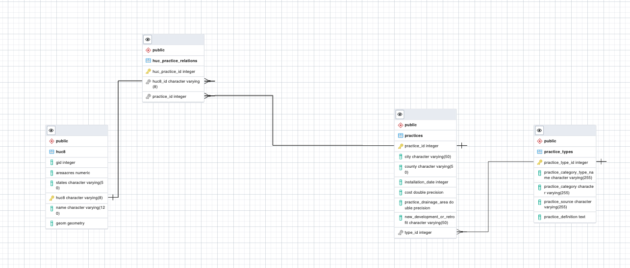
PNG File image-2022-9-3_11-55-58.png |
322 kB |
Vismayak Mohanarajan |
Sep 03, 2022 11:55 |
Sep 03, 2022 11:55 |
|
Page: Green Infrastructure Application
|
|
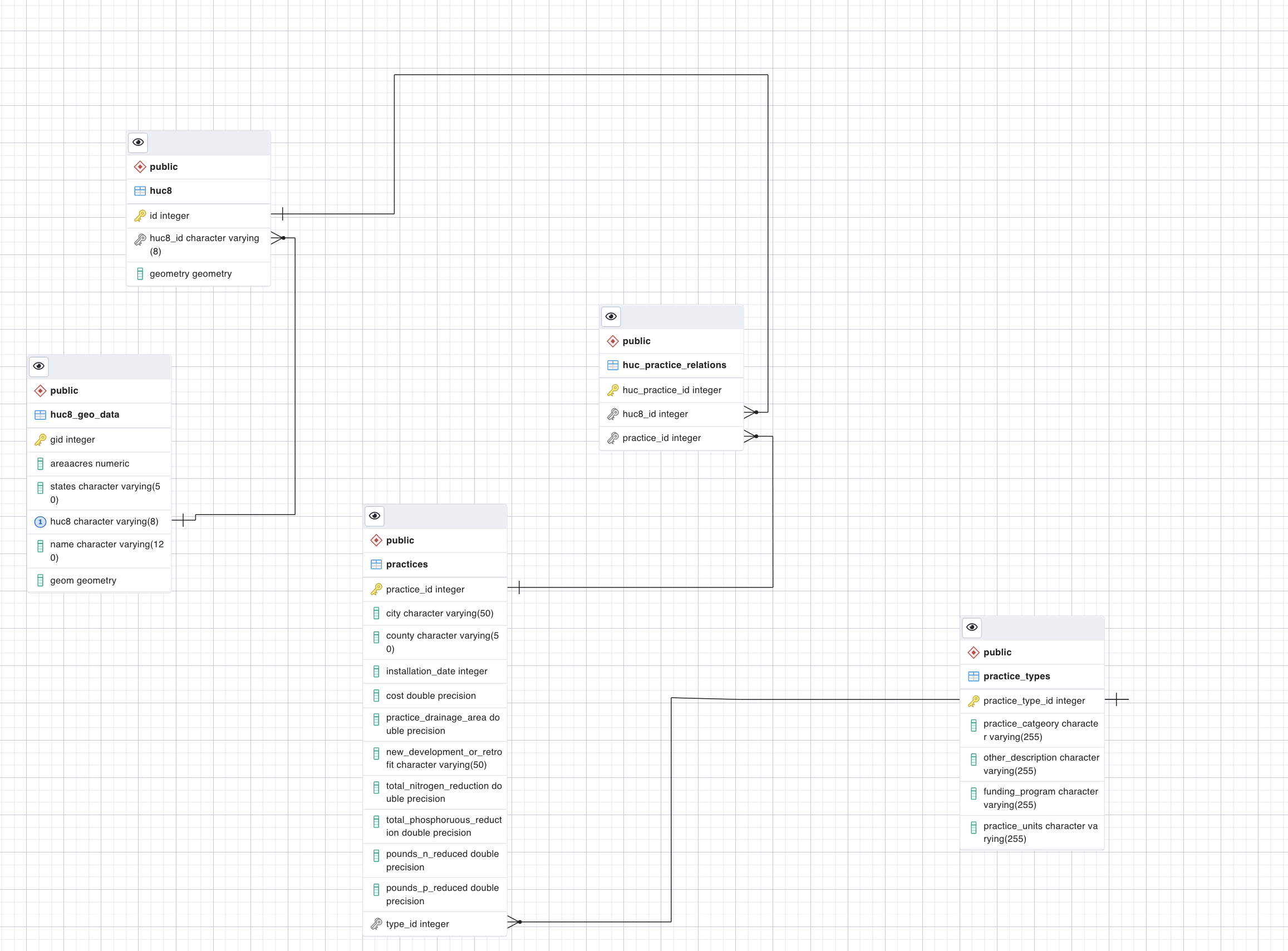
PNG File image-2022-9-3_12-4-20.png |
455 kB |
Vismayak Mohanarajan |
Sep 03, 2022 12:04 |
Sep 03, 2022 12:04 |
|
Page: Green Infrastructure Application
|
|
PNG File image2015-1-9 16:34:0.png |
0.3 kB |
Michael Brennan |
Jan 09, 2015 16:33 |
Jan 09, 2015 16:45 |
|
Page: GIS Layers/ Point sources
|
|
PNG File image2015-1-9 16:34:7.png |
0.3 kB |
Michael Brennan |
Jan 09, 2015 16:33 |
Jan 09, 2015 16:45 |
|
Page: GIS Layers/ Point sources
|
|
PNG File image2015-2-10 8:40:6.png |
0.3 kB |
Michael Brennan |
Feb 10, 2015 08:39 |
Feb 10, 2015 08:39 |
|
Page: GIS Layers/ Point sources
|
|
PNG File image2015-2-16 20:32:59.png |
73 kB |
Jong Lee |
Feb 16, 2015 20:33 |
Feb 16, 2015 20:33 |
|
Page: GIS Layers/ Point sources
|
|
PNG File image2015-2-17 14:19:26.png |
312 kB |
Jong Lee |
Feb 17, 2015 14:19 |
Feb 17, 2015 14:19 |
|
Page: GIS Layers/ Point sources
|
|
PNG File image2015-2-17 15:3:52.png |
0.3 kB |
Michael Brennan |
Feb 17, 2015 15:03 |
Feb 17, 2015 15:03 |
|
Page: GIS Layers/ Point sources
|
|
PNG File image2016-10-13 11:51:28.png |
43 kB |
Jong Lee |
Oct 13, 2016 11:51 |
Oct 13, 2016 11:51 |
|
Page: Impaired Waters by EPA
|
|
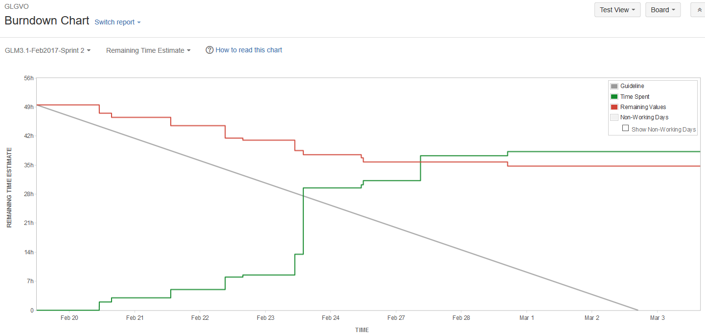
PNG File image2017-3-3 15:47:7.png |
38 kB |
Shannon Bradley |
Mar 03, 2017 15:47 |
Mar 03, 2017 15:52 |
|
Page: GLTG - 2017-02 February Sprint 2 Retrospective
|
|
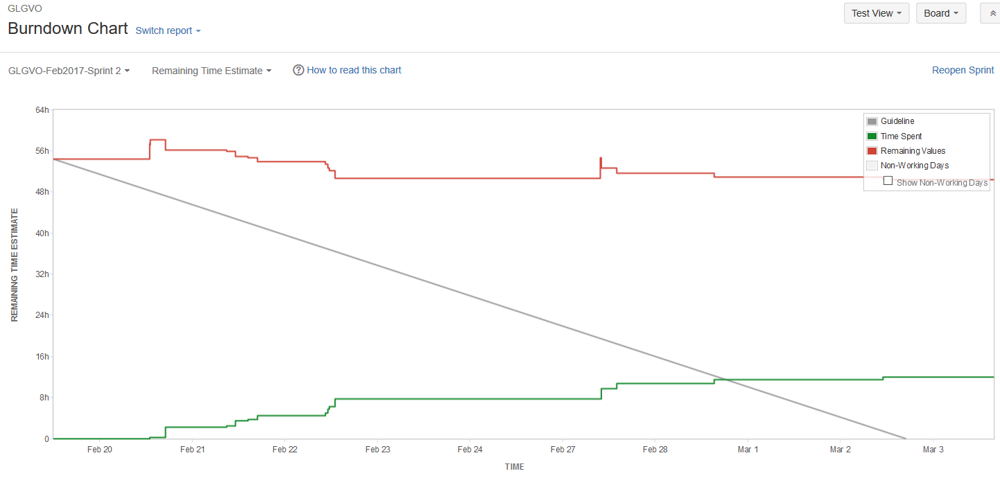
PNG File image2017-3-3 15:51:11.png |
37 kB |
Shannon Bradley |
Mar 03, 2017 15:51 |
Mar 03, 2017 15:52 |
|
Page: GLTG - 2017-02 February Sprint 2 Retrospective
|
|
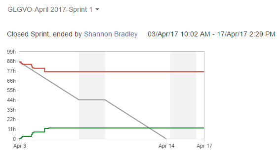
PNG File image2017-4-21 14:30:57.png |
20 kB |
Shannon Bradley |
Apr 21, 2017 14:30 |
Apr 21, 2017 14:31 |
|
Page: GLTG - 2017-04 April Sprint 1 Retrospective
|
|
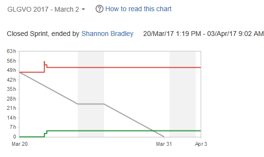
PNG File image2017-4-4 10:29:58.png |
10 kB |
Shannon Bradley |
Apr 04, 2017 10:29 |
Apr 04, 2017 10:34 |
|
Page: GLTG - 2017-03 March Sprint 2 Retrospective
|