Landing Page
| Functions | Data | View | Select |
|---|---|---|---|
| View Input data | |||
| MIR |
|
| |
| Weather |
|
| |
| Weather Forecast |
|
| |
| Run Model | |||
| Select input data |
|
|
Landing Page
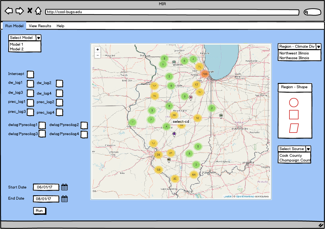
- Circles on Map show groups of sensors by count
- pills show single sensor (click on sensor to view details)
Landing Page showing sensors and sensor groups
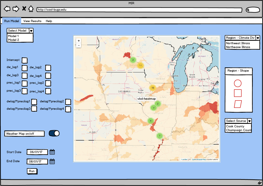
Landing Page Heat Map
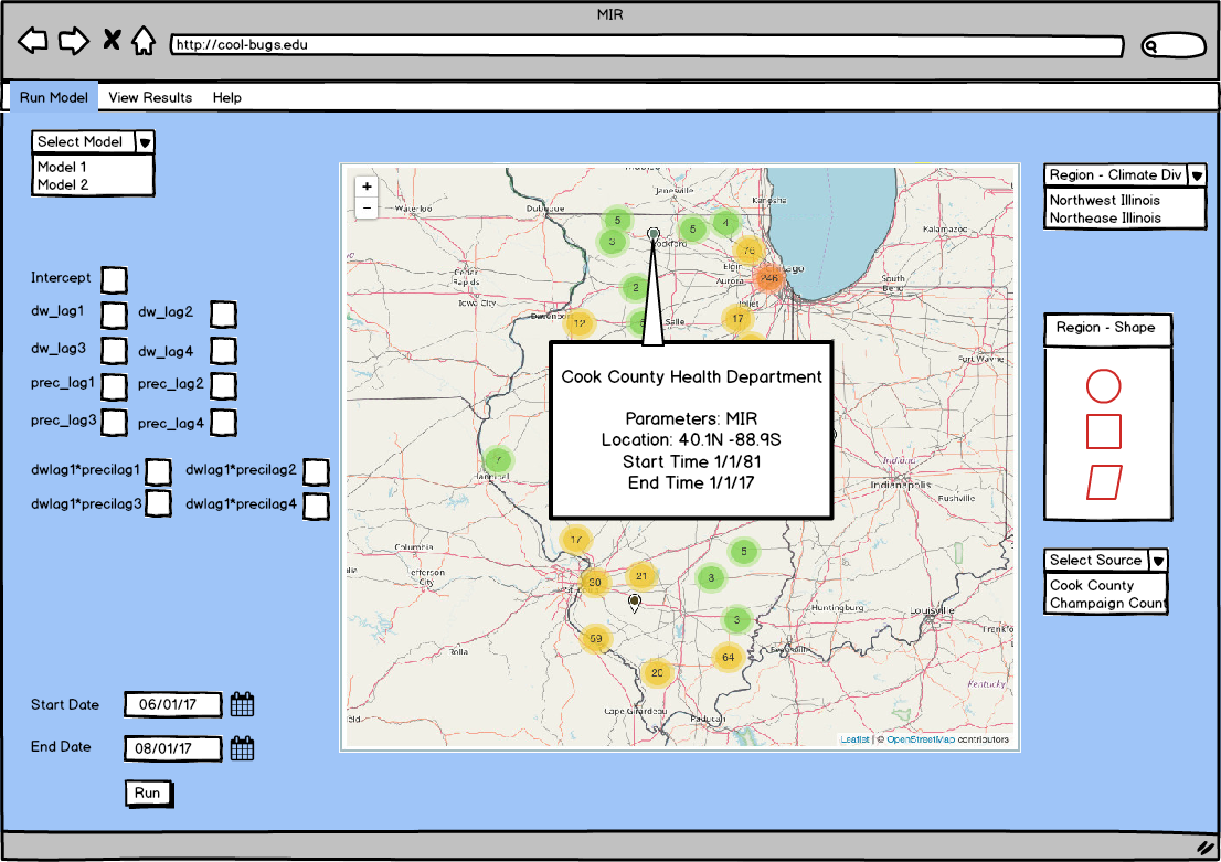
Popup
- shows details of that sensor
Popup of Sensor
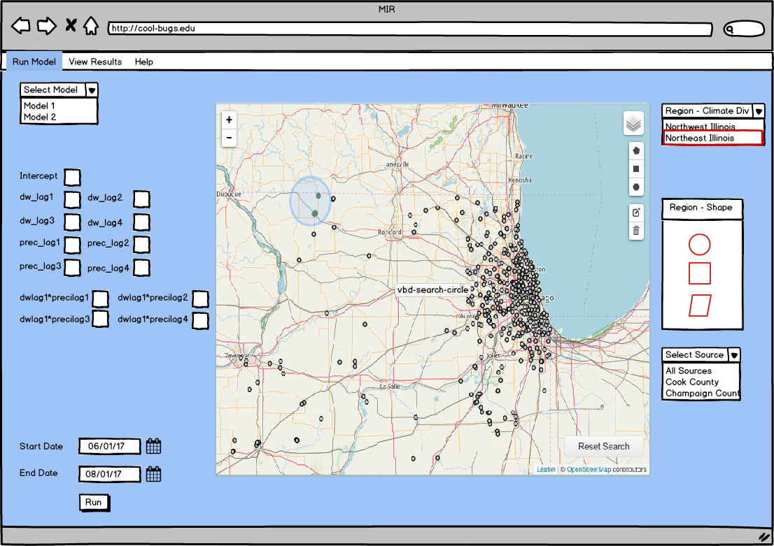
Run Model
- select input data
- primary - region
- can select by predefined shape (climate division or state)
- or can use shape tool
- secondary - source
- select a source from dropdown
- primary - region
- Select start and end date
- Press 'Run'
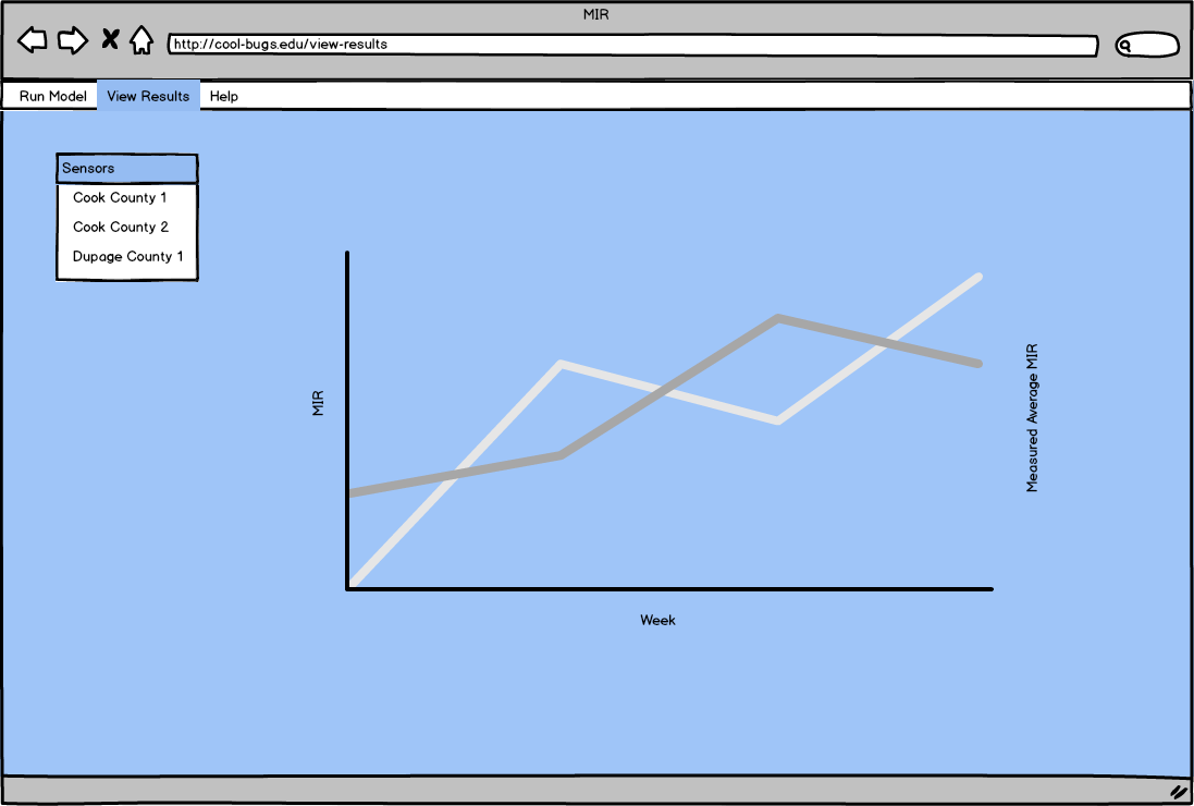
- Results show in separate tab (or possibly below map)
Select model region by climate division or state (then select further by source)
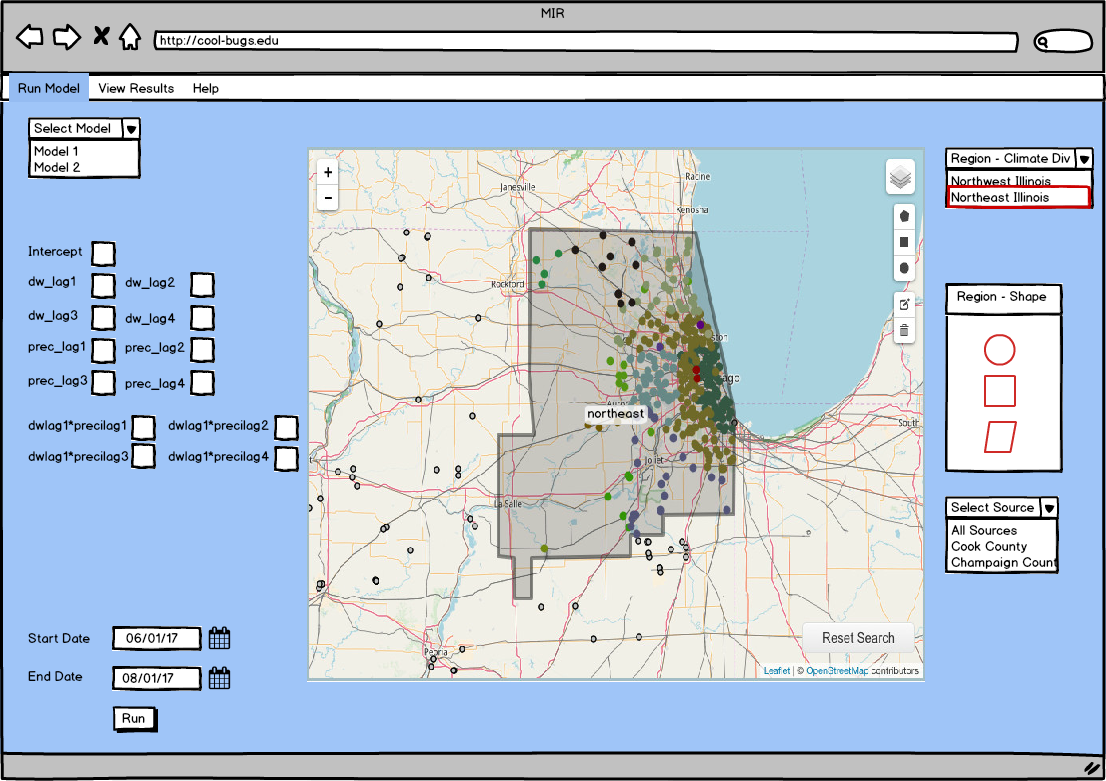
Select Model Region with selection tool
View Results
6 Comments
Kenton McHenry
Maybe put source first so the user can decide on the region based on what data is available for that region (like in PEcAn the map pins change based on the source). Why is region a drop down box? Can the user use the map to select the region also?
Marcus Slavenas
For region, the thought is that the user will select a climate division or state based on shape files - the model input data is based on state, climate division, and year. It would be good if the user could just click on the map, too - will add.
Kenton McHenry
So what would be in the drop down? A list of regions represented in the shape files?
Marcus Slavenas
yes, 'illinois northeast climate division' etc
Kenton McHenry
We should keep in mind then the eventual requirement to allow for interpolation of regions, i.e. for a user to select a region at random and pull the needed data from various datasets.
Marcus Slavenas
Got it. I'll add some shape selectors on the right.