-
Task
-
Resolution: Fixed
-
 Major
Major
-
None
-
None
-
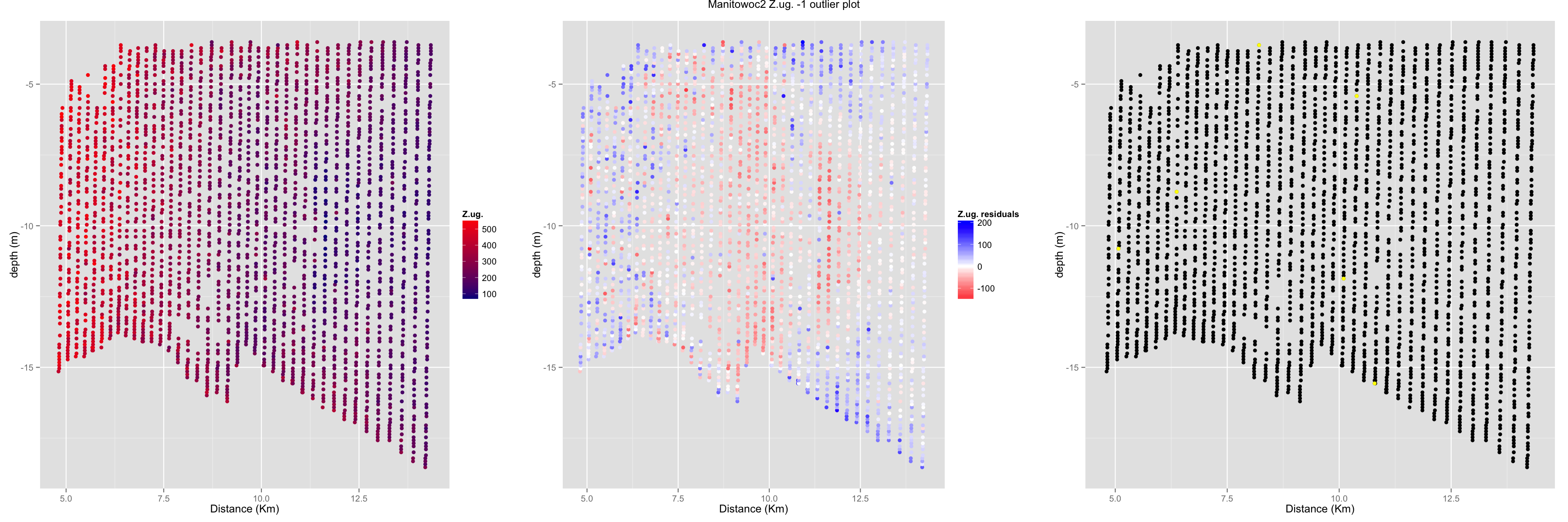
Triaxus
The zooplankton data (Z.ug/Z.dens) has some extreme large values in the data file and also some significantly different-than-neighbor points.
An spatial outlier detection algorithm called Median algorithm is implemented. First, thin plate spline is used to eliminate the global trend to make the residuals stationary. then median algorithm is used to detect the spatial outliers based on the residuals.
The left figure is the raw data of up-path data (zooplankton data shows an alternating pattern between up and down path, so the method is to do separate interpolation and do average). The mid plot is the residuals by TPS. The yellow dots in the right figure is the outliers. A threshold (number of outliers or difference level) is needed.
