-
Task
-
Resolution: Fixed
-
 Major
Major
-
Sea Grant 2.0-alpha 1
-
None
-
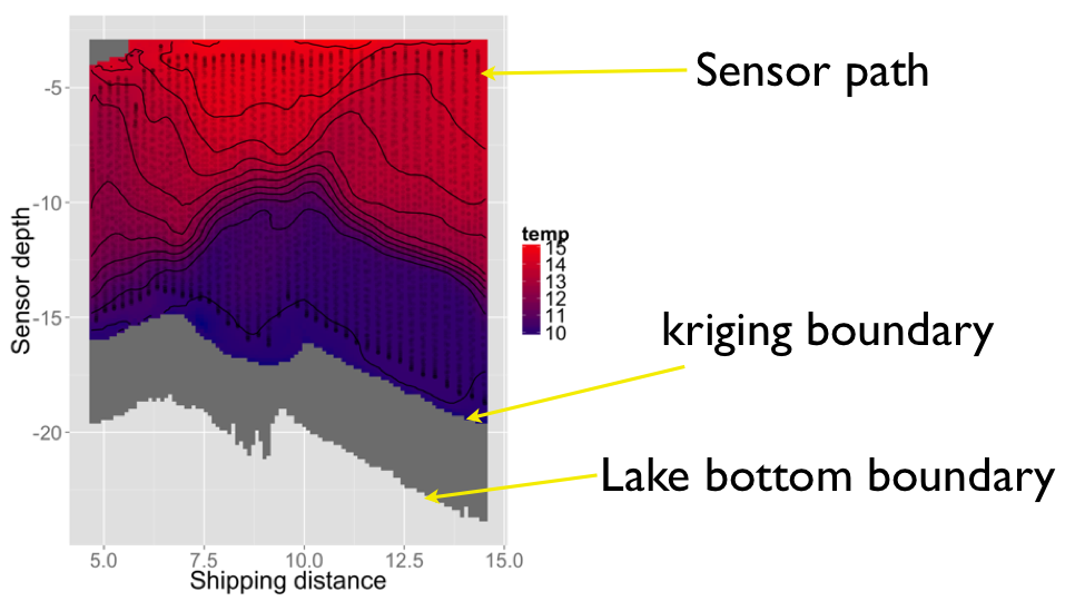
Triaxus Data set
The final interpolation will be like the figure. There is a problem of how to extrapolate for the area between sensor path and lake bottom. (grey part in the figure)