-
New Feature
-
Resolution: Fixed
-
 Normal
-
None
-
None
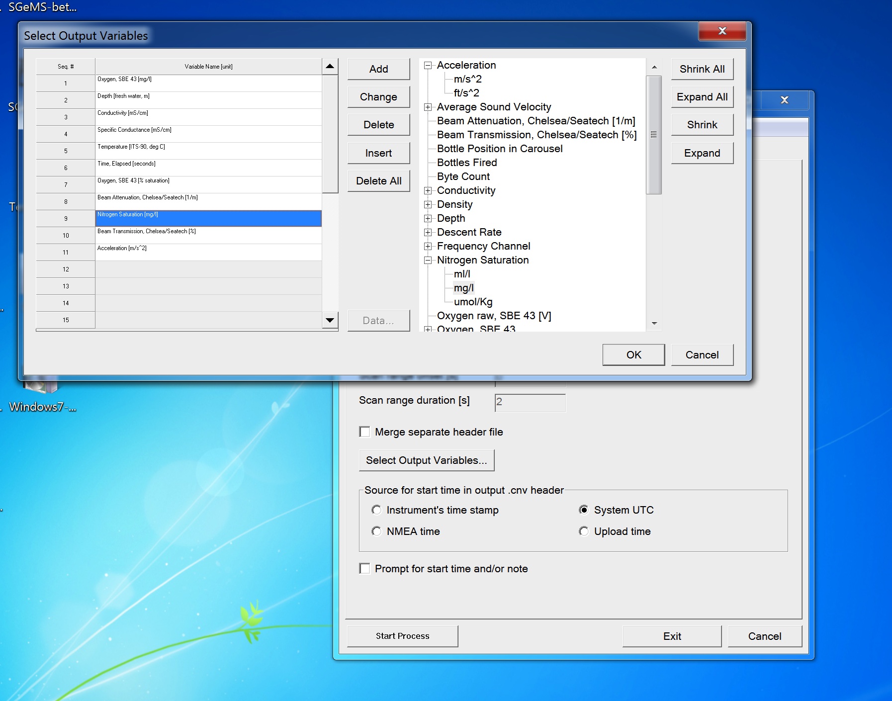
The raw data contains 5 folders:
lgdata01: LOPC data (.dat)
lgdata02: Flouroprobe data (.FLP)
lgdata04: Suna(Nitrogen) data (.csv)
lgdata05: Seabird data (.hex)
lgdata06: Phytoflash data (.XLS)
Problems:
(1) I use the software from Seabird company and it shows that Seabird data also contains nitrogen saturation data?
(2) It seems LOPC data files contain all other sensors data except Suna data. In LOPC .data file, the first character of each line represents the content of that line:
'#': header file
'$SDDBT': lake depth
'S': Seabird data
'L1' to 'L5': zooplankton data
'F' :Flouroprobe data
'$GPGGA': location of the ship
'C': Phytoflash data.
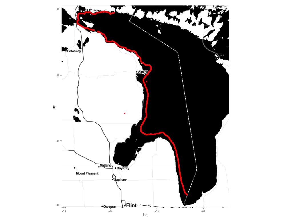
The cruise path in Lake Huron is shown in the attachment
