-
New Feature
-
Resolution: Unresolved
-
 Cosmetic
-
None
-
None
-
None
-
Server & Client
-
GLGVO Backlog, New GLGVO Backlog
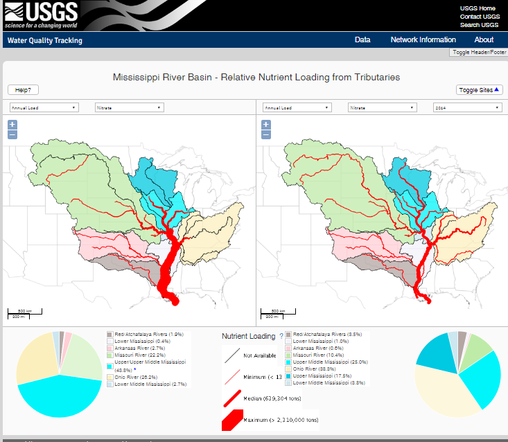
Visualize the water quality by using loading with river and watershed as shown in attachment.
We need
- analytical model to compute the loading for each river seqments
- visualization tool to show like in attacehment
- is related to
-
GLGVO-145 Identify USGS Gauges to pair discharge with GREON buoys
-

- To Do
-